Showing posts with label southwest chief. Show all posts

Thursday, 27 October 2016

New Mexico Trip #37: Wheeler Peak Expedition, Part 2

Hike #2

We scheduled a full day off between hikes, enabling a few scenic drives and visits to other towns.  With our first big hike behind us, we took a relaxing drive through the mountains, heading south from Sipapu to Mora and Las Vegas.  We have visited Mora once before, and wanted to do so again.  Largely it is a small Hispanic mountain town that time seems to have forgotten.  Our main interest in coming here was to revisit the Mora Valley Spinning Mill and Coffee Barn.  This is a beautiful shop, with locally produced and manufactured (by hand) woolen and alpaca goods.  Deb ended up buying a winter hat and gloves.  Mora is only about half an hour from Sipapu, following a highly scenic drive.  The town itself is surrounded by unique mountains.  Half an hour south of Mora is Las Vegas (NM), a much larger town with a train station and interstate access.  The town straddles the mountains to the west and the Great Plains to the east.  We visited the Old Plaza here once again (it had been many years), greeted the Southwest Chief at the Amtrak station, and had lunch at El Fidel, located near the station and within a working, historic hotel.

Our Sipapu room had a fireplace, and we were able to stock up on firewood in Mora.  It was an adventurous day spent in civilization, after being completely alone all day yesterday.
One does not need to hike to enjoy the autumn splendour of NM.  The drive to Mora from Sipapu crosses a high mountain pass before descending into the Mora Valley.  This photo looks back at the pass we crossed on our way south.


Hermit Peak looms over Las Vegas, NM.  There is exciting hiking to be done in this area, which remains unexplored by us.

Southwest Chief pulls into Las Vegas station, heading west.  We have passed through on the Chief twice westbound and twice eastbound, but this was our first "outside" station visit to Las Vegas.


 Early moonrise, as seen from our balcony at Sipapu (Apartment 9b).


 Friends came to visit us on our balcony, too.  Even more often when we began handing out peanuts.


HIKE #2:  South Boundary Trail:  7.9 miles; 7200'-9215'; 6 hours:  This hike was a bit longer than the first one, and involved more elevation gain.  However, last hike we had begun at 9200', and today we ended at that elevation.  This hike begins only 2.8 miles west of the main Plaza in downtown Taos, so it is a busy one.  Bicycles were allowed, but not hunters.  We saw three bikes all day, and two of them passed us while we were at our off-trail day camp.  We did meet about 10 hikers, and ended up chatting and mostly walking back down afterwards with two young women.  We were in no rush to get started, enjoying a leisurely breakfast at our cabin, but were climbing by about 10 am.  Much of the time we were in the pinon-juniper belt, with the landscape dominated by these two types of trees.  The trail was very good, though rocky in places.  It was a steady uphill pull, with some sections becoming very steep.  At about the 8500' level, ponderosa pines took over the forest, along with other mixed conifers.  There were aspens near the summit.  This was not a mountain climb, though stupendous views opened up early on.  We hiked to the junction with a major trail at the 9200' level, found a place to relax, and enjoyed our time aloft.

 200' contour map of Hike #2.


 My source of drinking water today was the Rio Fernando.  A small
footbridge crosses the Rio from the parking lot, and the trail begins.

The trail follows the river a short distance before it begins to climb.  It felt like Lothlorien!


 Deb gets ahead of her photographer on the South Boundary
Trail.


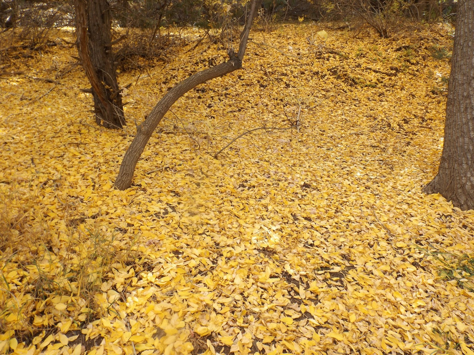
River of Gold!!  Once we gained a bit of elevation, we could see the cottonwood 
trees along the Rio Fernando, and also Hwy 64.  Looking east.


Aspens in the high country!


Wheeler Peak from our day camp.  It is the peak on the far left of centre, way back.  Our view today was  much closer than from Hike #1.  It was hard to believe we would be attempting to get up that mountain in only two days.  My knees felt all wobbly.


Deb at our Hike #2 high point and day camp.  Wheeler Peak in back left sits 4,000' higher.  It kept beckoning to us.


Looking northwest back towards Taos.  The thin, black, horizontal line in the mid-distance is the Rio Grande Gorge.


Interesting clouds above our trail.

After the hike we went back into Taos for coffee.  Then, after a stroll round the plaza, we went for dinner at Eske's Brewpub.  Their green chile beer and green chile enchiladas are pretty hard to beat.  And there is always lots of food left to take home.  Next day we came back to Taos, visiting a different brewpub.  We also made a major art purchase at our favourite gallery, a stone knife made in prehistoric fashion by one of the masters of the trade.  I will try and include a photo of it in the third and final blog entry...
 This place had over 20 taps--I managed to try three.  Hoping to return!!


 Pooh and I watch for honey bees in Taos Plaza.


Deb heads towards Taos Plaza.


Even the sewers are worth checking out in Taos!


Taos Mtn., seen from downtown Taos, NM.


The third and final entry in this series will describe our third and final hike, the "Bucket List Hike" to Wheeler Peak.  Hope you come back!
Mapman Mike

To be Cont'd... 


Saturday, 17 October 2015

Colorado and New Mexico, Parts 7 & 8

Part 7:  Final Day and Night in the Southwest


We awoke Sunday morning in Raton with one full day left to explore, and one more night of camping.  Monday morning we would begin the long drive home.  Raton sits at the bottom of Raton Pass, with Trinidad, Colorado on the other side.  The Southwest Chief climbs the pass each way on its journey to either L.A. or Chicago, and it is one of the main highlights of the train journey.  We had plans to be up in the mountains when the train came up from Colorado this morning, and hoped to get a few shots of it climbing the pass.

Afterwards, we headed into Trinidad, a small tourist town that has seen better days.  However, just north of town was one of the finest microbreweries a craft beer drinker could ever hope to discover!  I spent a lovely time here sampling the many fine offerings, vowing to return.  Needless to say Deb did the driving for the remainder of the afternoon.  We eventually made it to Clayton Lake State Park, famous for its dinosaur footprints.  We had visited years ago with my parents.  This time we were there to camp, and we were able to snag the best campsite in the park!

After a very pleasant moon rise and decent sleep, we packed up the truck for good, departing early Monday morning for the journey home.

 Fisher's Peak looms over Raton Pass and Trinidad, CO.

 The Southwest Chief climbs Raton Pass, heading for New Mexico.  There is a long tunnel just after crossing the state line, and then the grand descent into Raton.

 Wall map, cafe in Trinidad, CO.

 An eye-catching van in downtown Trinidad.  A cafe and two stores were open on this Sunday.  Some tourist town!

 Dodge Creek Brewing Company, just north of Trinidad.  Home sweet home!! (They have closed since and moved to Dumas, TX.  Now called Topple Turtle Brewery).

 Troy's ESB was to die for!!  My favourite beer ever!!  I tried them all, plus a coffee stout that was busy brewing in the back.  What a great place, and super friendly!!

 Two-lane classic roads took us a back way from Colorado back into northeastern NM.  First Officer Deb was at the wheel.  I kept her entertained with my witty drunken banter.

 Sierra Grande, one of many extinct volcanoes in northeastern NM.

 Rabbit Ears Mtn is passed on route to Clayton Lake State Park.  Heading eastbound, it is the last mountain seen before the great plains are entered.  Westbound along US 56, it is the first mountain encountered.  US 56 follows the old Santa Fe Wagon Trail, which brought settlers from Kansas City, MO to Santa Fe, NM.  Wagon ruts can still be seen on Google Earth, or in person.

 View from near our tent site, Clayton Lake State park, NM

We set our tent up atop this outcrop, overlooking the lake.

 Our tent was on the opposite side of our vehicle, Clayton Lake, NM

We had about 20 minutes of dark sky before moon rise.  It was one day past full.

Part 8: Heading Home

Clayton Lake State Park straddles the prairies and the mountains.  We said goodbye to the park around 8:30 am, beginning our first of three long days of driving home.  Original plans had been to camp the first night (Monday) in eastern Kansas, but temps were due to rise to nearly 100 F today.  We preferred an air conditioned motel room.  We drove straight through to  Lawrence, a gruelling 514 miles.  All but 99 miles of it was on two lane, so at least it was a pleasant and scenic drive.  We stopped for coffee in downtown Great Bend, KS, where it was 99 F.

Next day we plowed on till Effingham, IL, 401 miles from Lawrence.  We had lunch at Main Squeeze in Columbia, MO.  Our final day home was 462 miles, and it was plagued by detours caused by construction and freeway accidents.  We arrived home exhausted but relieved to have made it safely.

Saying goodbye to Clayton Lake, and to NM, as we pulled out and headed for home.

 The scenery never stops.  Here we are passing through beautiful downtown Sublette, KS.

Inside 23rd St. Brewery, Lawrence, KS.

 Morning in downtown Lawrence, KS.  Deb went to Yarn Barn before we left town.

At only twelve days, this turned into our shortest of the seven road trips we have made to NM.  The falling Canadian dollar had something to do with it, but I also wanted to be back on time and rested up for the next astronomy session.  The next big drive west, possibly in October 2017, will be with our telescopes as we attend the Socorro Star Party.  I'm already looking forward to that one!

Friday, 9 October 2015

Colorado and New Mexico, Parts 5 and 6

Part Five: Hikes #3 & #4

We stayed two nights at Sipapu.  They were building a new ski lift, and we were warned about an early morning helicopter coming on Friday and working throughout the day.  We were checking out that day, so we didn't mind.  We spent Thursday mostly at the resort, resting, writing, exploring.  We had a wonderful fire Thursday night in the large fireplace.  Three miles further up the road was Agua Piedra Campground.  We ended up staying here Friday night, as our Friday hike began and ended here.

We left Sipapu around 9 am, watching the helicopter carry a cement bucket up and down the mountain.  At the last minute we remembered to purchase rain ponchos at the little shop.  We drove up to the campground, selected a site, paid and parked our vehicle there.  We geared up for our hike.  This was to be the biggest of the hikes we had planned, as well as the final one.

Hike #3: Trail 19A, Agua Piedra:  The hike was 8 miles long, with nearly 2,000' of elevation gain.  We began at 8500', and it was a steady uphill grind much of the way to a high saddle.  From here we climbed further on a side trail, trying to achieve a bare summit.  However, due to in-coming storms we had to abort mission to climb the hill.  We ate our lunch at a beautiful overlook, sitting on a convenient log, then headed back down.  The torrential rains caught us about half way back.  The ponchos were life savers!
 The trail begins at Agua Piedra Campground.

Near the beginning of the hike the trail skirts a lovely mountain meadow.

 Even though we climbed to over 10,400', there was always much higher country all around us.

This should have been my summit conquering photo, but alas incoming weather sent us back downhill all too soon.  We got properly drenched before we made it back to the vehicle.

 From a distance we thought we had come across some red rocks.  However, closer scrutiny proved otherwise...

 Appearing like red rocks from a distance, the rocks were actually covered in orange lichen!

Jicarita Peak, at about 12,600', looms more than 2,000' above us. 

We were soaked from our knees down by the time we returned.  It was a big, bad storm, and thunder crashed around us and lighting flashed not far away.  The trail turned into a downhill rushing streamlette.  This trail had about 10 river crossings, where one has to pick his/her way over logs and across stepping stones (which tended to move a lot when stepped on).  So though we walked quickly back down in general, we had to really slow down at the many crossings.
Once back at the car, we changed into dry clothes and hung the wet ones on our hastily erected clothesline.  It stopped raining, and by sunset the nearly-full moon was rising.  For a Friday night in August the campground remained remarkably empty.  Besides us there was one other camper (in a trailer, quite far from us) in the entire huge section.  So we spent a pretty quiet night.  It was way too damp to attempt a campfire.  Besides, we were exhausted from our hike.  Bedtime came early.

Next morning we were up early.  It was a chilly 46 F.  We made tea and oatmeal, packed up the tent, loaded the truck and were ready to depart by 9:30 am.  Today was supposed to be an epic drive, first through the Rockies and out the eastern end, then onto the plains for the afternoon.  However, we had spied a spur trail yesterday.  Trail 19C said "Indian Lake."  We were intrigued.  We had both survived the ordeal yesterday and were ready for a lesser hike today.  So off we went!

 Hike #4:  This one came in at around 4 miles and 1,000', about half of yesterday's epic challenge.  I ended up forgetting my camera in the car!  Luckily Deb had a phone with her, and she took the next few pics with it.  Otherwise, there would be nothing to show you.  This is a beautiful walk through deep woods and up into the high country.  The pond (no lake here, my friends) sits at about 9,500'.  We were so used to altitude by now that we could breathe pretty normally up there.  Being a Saturday we expected (and got) several other hikers.  We had been completely alone all day yesterday.  However, we managed to climb to the lake, visit it, rest there, have a snack, take pictures and then begin to head back down before we met anyone else.


Indian Lake is more like an alpine pond.  Two ducks were happily swimming about!

This shot shows the incredibly beautiful park-like setting of Indian Lake.  We walked around the pond and got comfortable by one of the big evergreen trees, taking our snack break and well-deserved rest. 

 This was the view back, taken from our rest area in the pines.

 The author at Indian Lake.

 View of the high country as we prepared to descend the trail (19C) and back to our vehicle.  We still had a long drive ahead today, as we began our return east.  We would still see mountains for the rest of today and most of tomorrow.

Part Six:  Agua Piedra to Raton, NM

This is a long, very dramatic drive.  Mountains, valleys, towns, villages, high passes--it is a fabulous journey!  We climbed to over 9400' as we recrossed the Rockies, stopping in Mora, NM on the other side.  We had lunch here at a little Mexican restaurant.  They took good care of us!  Next came a stop at a yarn mill.  Deb was overjoyed!  And they had espresso!  Her feelings of joy could not be contained!  I sat on a bench and waited.
Mountain scenery and dramatic weather equals a perfect drive in New Mexico.

Baldy Mountain near Eagle Nest Lake exceeds 12,000'.  We stopped nearby at a ski resort town (Angel Fire), waiting out a bit of rain and lightning.

The Southwest Chief arrives in Raton, NM exactly when we did (5 pm)!  We've been to the little station four times on this train, twice westbound and twice eastbound.  It was fun to see it arrive and leave from the sidelines, so to speak.  Note the puddles remaining from afternoon storms.

Portrait of Deb at Raton.  We both would have loved to jump on the train and go!

View from our table and chairs at our little motel in Raton, NM.

It took us about five hours to drive from the campground to the town of Raton.  Raton is near the border with Colorado.  Though we were heading to a New Mexico campground tomorrow night, we would dip into Colorado next morning and afternoon before recrossing the state line.