This is Part 4 of a five part blog. To begin at Part 1, scroll down or click on "Older Posts."
We had a leisurely drive north to Mountainair from Carlsbad. We had stops in Artesia and Roswell. Artesia, on our last visit many years ago, was a a dusty nothing of a town. It is the setting of the David Bowie SF film The Man Who Fell To Earth. Today all that has changed. It has a very attractive hotel downtown, restored and expanded, as well as a main street lined with shops and eateries. We visited an antique store, as Deb was looking for some items for her next film project. We will be happy to return someday to this bustling little prairie town. Further north, Roswell has gone alien crazy since our last visit, which was again many years ago. Everything now has something to do with aliens. We stopped downtown for more antique browsing, as well as for lunch. It was a sunny, beautiful day on our visit. However, in two days from now Roswell was to endure their worst flooding ever. Two people were killed and several dozen rescues took place. Many of the downtown stores lay in ruins.
Our destination was Mountainair, a small village that lies along US 60, and is also adjacent to the busiest portion of the national railway (freight only). Trains pass through town about every 10-20 minutes, all day and all night. We chose a vintage hotel for our stay Thursday night. The Schaffer hotel was opened in 1923, and is featured in many books on historic hotels. Staying here was an experience we will never forget. The room itself was tiny and quite pathetic, but the bathroom was large and very impressive. To check in we had to call a phone number listed on a sign in the window. The owner then gave us a code to open the front door. We were told to go up to Room 6, which was unlocked. The key was in the room. We were to leave the key and $80 in the room when we left, leaving the door unlocked. At first we were all alone in the hotel, which is quite large with about 18 rooms. We had eaten in the dining room years ago, but never stayed overnight. It is worthwhile to look up photos of the Schaffer Hotel, to see how remarkable this place really is. The dining room ceiling may not be equivalent to the Sistine Chapel, but it's pretty fine. Sadly, I took no photos. The lobby is large, has a high ceiling, furnished comfortably, and has original art on the walls. I spent some time here in the evening writing up my notes. The restaurant was closed today.
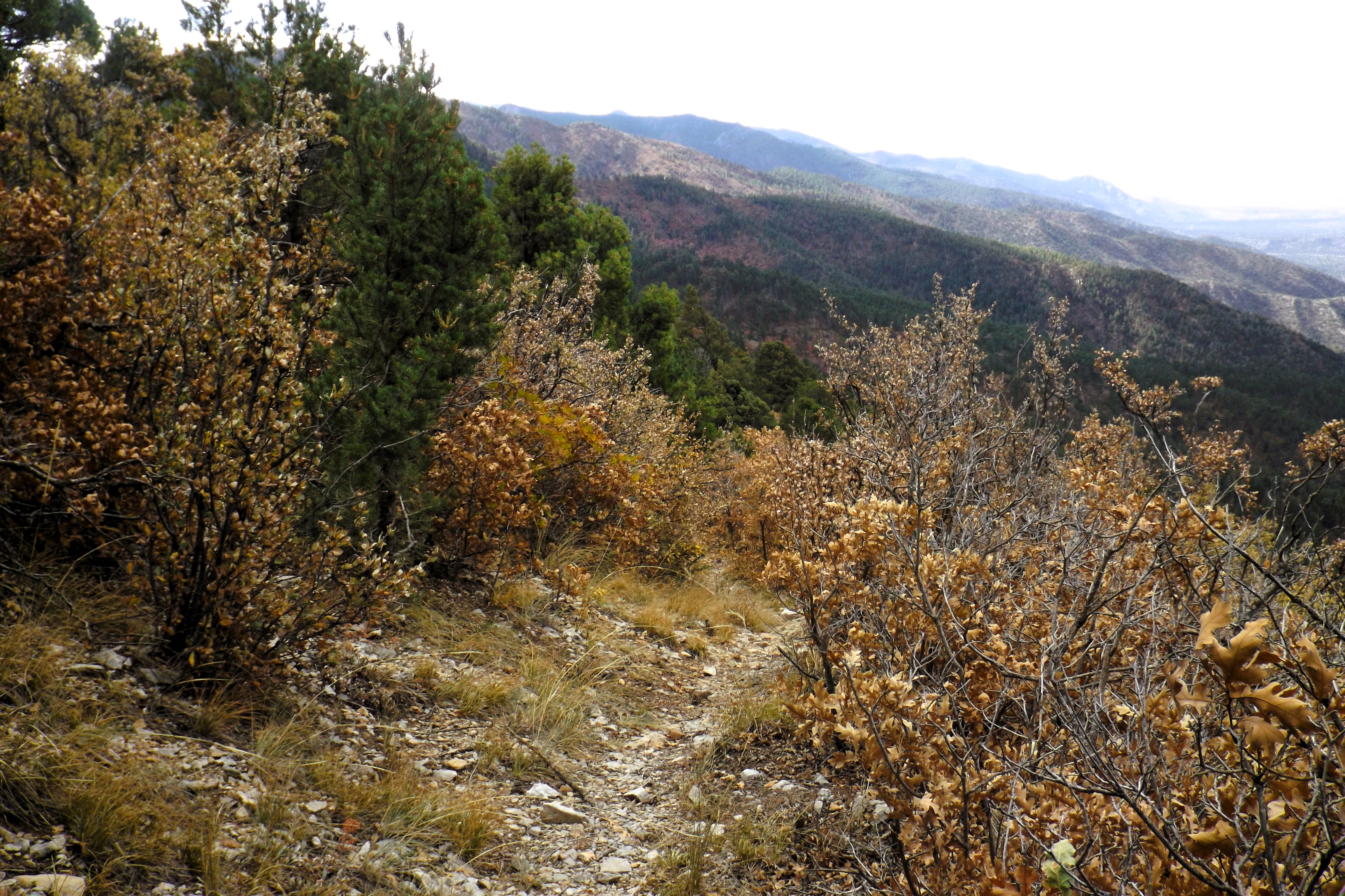
Next day was our hike in the Manzanos (Apple) Mountains, our only hike in NM this time around. We have done three previous hikes here, as we try to complete the "Crest Trail," which follows the top of the mountains. Today's hike would be different, though, as we would drive to the summit and then hike down to a trail junction we had used on our last hike here, again many years ago. The lower forest had some fall colours, but the upper altitudes were in decline. The mountains had been closed for several years due to a massive fire all along the east side. The devastation left us stunned today as we drove upwards.


The hike today was down and back up the same way. Round trip was 6.3 miles. I dropped from a start of 9243' down to 8240'. As usual, though, it wasn't all downhill for the first part, meaning that I had some uphill battles on my way down, added to my expected ones coming back. I ended up doing about 1220' of elevation. Deb walked the first mile with me before stopping to rest and turn around. She ended up doing about 650' of elevation. Let her tell you the story some time of how she accomplished it.


After this we had a two night stay in Albuquerque planned. The rest of the road trip, including Albuquerque, can be found in Part 5, the final segment of this trip blog.
Mapman Mike
No comments:
Post a Comment