Our 2nd hike of the trip (we would accomplish four of them) was to walk up the steep side of an extinct volcano. The Cerro Americano hike was done on my 65th birthday. It was only 3 miles, with 500' of elevation gain, but it was a treacherous climb, much steeper than any photo would indicate. It was very loose sand and rock, with a few scattered tufts of grass to help with footing.

Our route up and down Cerro Americano, our 2nd hike of the trip. The summit is 8075', making it the lowest hike of the four we did. The hike begins at 3 o'clock in the above Google Earth image, and proceeds counterclockwise. It was a strenuous hike despite its low mileage and elevation gain.

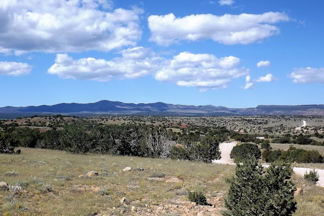
Cerro American rises 500' above the plain. It doesn't look so bad from here, but it was! Think of a 50 or 60 storey building....

Volcanic rock near the summit of Cerro Americano. And Deb.
We took our sweet time ascending and descending, as a fall, once begun, would be unstoppable until the bottom. Our GPS trail is shown in red in the map, above. We parked Beorn and hiked northwest, passing an encampment of hunters, who were not very active this time of day. Once at the top of the mountain we had excellent 360 degree views of dozens of other cones and volcanic outpourings, including Mt. Taylor, the largest mountain in the area and our hiking goal for Monday (today was Saturday). The summit today was an open bowl, washed away on the north side, giving it a horseshoe shape (see our trail at the top, where we followed the rim). We could have climbed down into the crater, but once aloft we preferred to stay up top for awhile. It was a challenge to find shade and a log on which to sit, but we managed. After lunch we headed back down, going almost as slowly as we did climbing. The steepness of the slope was extreme. Slow speed danger, one might say.

Cerro American summit, from the highest point and looking across the bowl, or crater, to the far side. We followed the ring of the summit all the way around, eventually eating our lunch on the far side.

Summit view looking northeast. All mountains in view are extinct volcanoes, including Mt. Taylor in the far background, where clouds are gathering.

Now looking southwest from Cerro Americano, with more extinct volcanoes in view.
Once back at the truck, we headed back along the very wet and rutted dirt road. We made a detour to visit some lava tube caves near the edge of El Malpais Wilderness, a vast area of volcanic doom that still shows clear evidence of the destructive power of lava. The caves can be found by following well camouflaged cairns. There is no trail, just sharp rock. We visited one lava tube, all of which were once conduits for underground lava flows. As time went on the roof caved in, making tunnels with occasional openings, allowing access. Again, we did not descend into the tubes today, but merely stood above them and looked. We hope to return here someday and get right inside of them.

Deb stands near the edge of one of the holes allowing views into the lava tubes.

This arch looks ready to collapse, but for now one can cross it to the other side. Lava once flowed through this channel.

Somehow a forest has sprung up over top of the lava. It has taken about 1500 years to get this far with natural recovery.
______________________________________________________________________
Our third hike was to the highest summit of the Zuni Mountains. Mt. Sedgwick is in the north Zunis, and entailed a long drive around the mountains, and then south into them from I 40. Once leaving the area of the freeway, we were on good gravel and dirt roads.


Before we were done driving today, Beorn would be a lot muddier.

Mt. Sedgwick looms in the distance, as the highest peak in the Zuni Mountains. Our road crossed the high plains, then climbed into the forest.
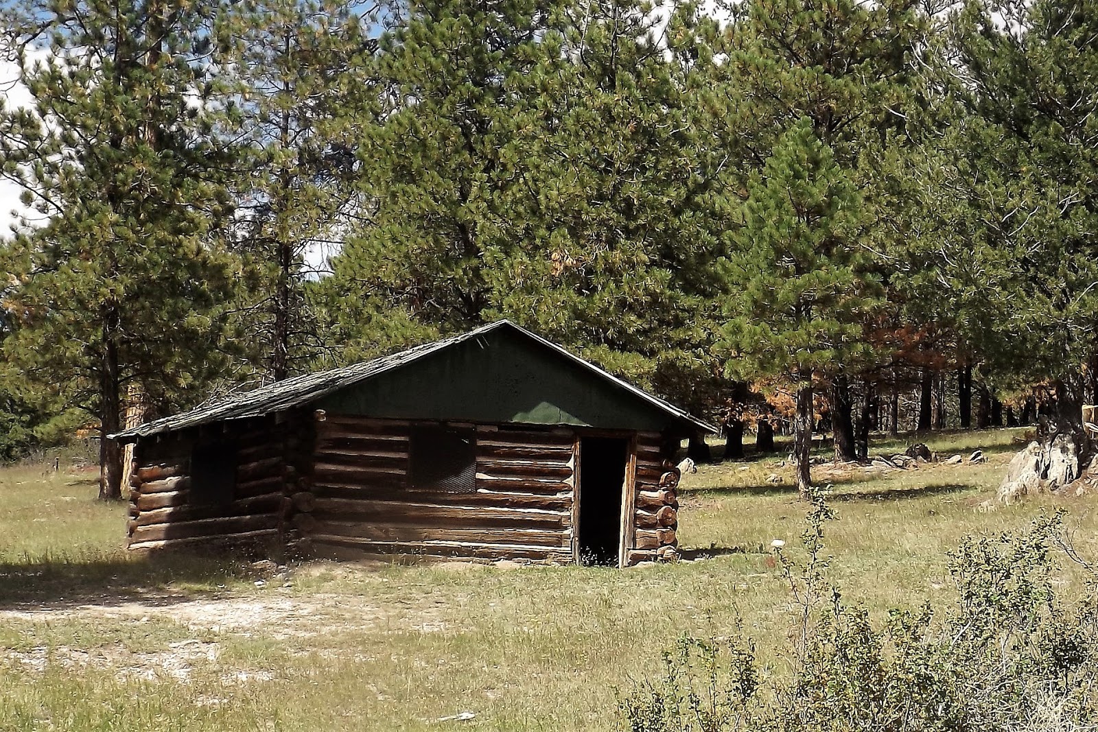
Our hike begins at this old forest cabin, just before reaching Ojo Redondo campground, following an old forest road.
Today's hike was 5.4 miles, with 740' of altitude, topping out at 9,266'. This was over 1100' higher than yesterday, but 1400' lower than our hike in the Sandias. Still, it was pretty high, and our lungs were feeling it. The hike was along a dirt road, so it was much easier than yesterday's wilderness scramble. In April the area was hit by a massive forest fire, one of two bad ones to hit NM in 2018.

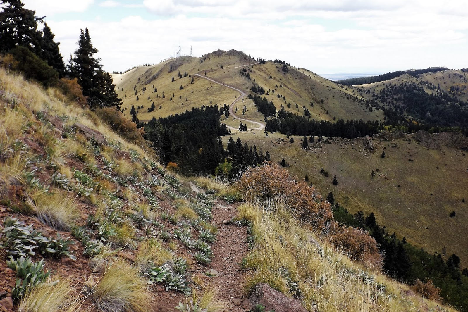
Mt Sedgwick is in the upper right, and the forest cabin is in the lower left. This was quite a lovely hike, though marred by a lot of cindered forest. Had we hiked a year ago we would have seen things at their very best.

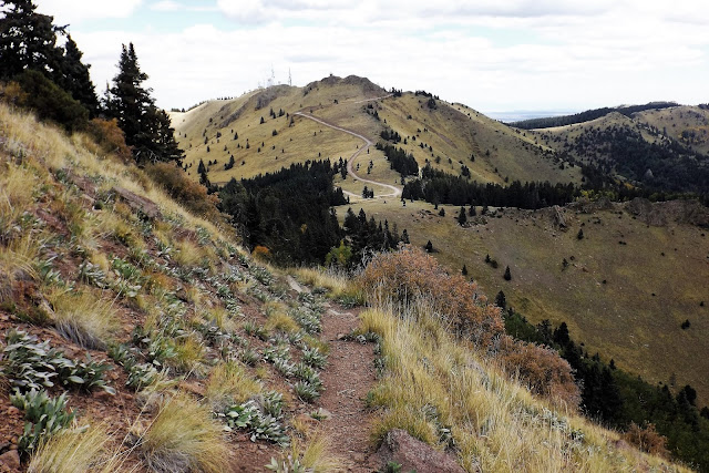
Approaching Mt. Sedgwick, and experiencing the extensive burned area.

Summit view northwest, towards red cliffs and Gallup, NM. We shared the summit with a small herd of skittish cattle.

Looking towards Mt. Taylor (tomorrow's hike) from Mt. Sedgwick. The distant peak is 2,000' higher than our present location. Did I mention yet how beautiful the weather was during all of our hikes? It was amazing!
_________________________________________________________________
Our 4th and final hike of the journey was to the summit of Mt. Taylor. It involved a considerable drive from downtown Grants. In the past, the final road to the summit has been awful, filled with large stones, potholes, and bare rock. However, this year the road was nearly perfect, and that eliminated a long walk for us. The summit of Mt. Taylor can be easily reached if one is able to drive all the way up to the high saddle between Mt. Taylor and its near neighbour, La Mosca. These two summits are the highest peaks around until one gets into the Rockies near Santa Fe. We hiked up to Mt. Taylor and back, and then drove up to La Mosca, where there are electronic towers and a forest fire lookout. We met two other hikers, who arrived at the summit from a different approach, after we had been up there for awhile. We were able to take each others group photo!


Mapman Mike

It is a very scenic mountain drive from downtown Grants to the high country beneath Mt. Taylor.

We parked at a high saddle at over 10,000', with views towards the La Mosca fire tower and electronic towers. That worthy summit is a few hundred feet lower than Mt. Taylor, but the views are just as good.

The double line indicates our ascent and descent of Mt. Taylor on foot, including a side excursion to a rocky outcrop. The single line indicates our drive up to La Mosca.

View south from Mt. Taylor.

Summit view, Mt. Taylor.

Summit view, showing the opening where lava once flowed freely into the plains.

L to R: Me, Pogo, and Deb. This was our trip highpoint, and it was plenty high enough! We remained aloft for a long visit, including a picnic lunch. We were joined by two young men who had come up via a longer and more strenuous trail. They had assumed that the road was too bad to drive up, and were surprised to hear it was in good condition.
Our return trail, showing the road up to La Mosca towers. When our hike was completed, we drove up that mountain for more fun and adventure.

Looking up towards La Mosca fire lookout from the electronic towers after our drive up the mountain. Beorn needs a bath!

2nd highest summit in the area.

View down to Beorn, at 10,950', and the electronic site. Note the football field left of the towers, a remarkable natural phenomenon.

View north from La Mosca.

It was September 24th, but autumn was well established in the high country.

Once back down in civilization we headed for coffee, than a car wash, and then on to this amazing brewpub, sharing digs with Lavaland RV Park! They had excellent home brew, and this place is on my permanent happy list!

An amazing sunset over Mt. Taylor, as seen from our hotel balcony in Albuquerque that night. It was also a full moon, and our final night in NM. Tomorrow the long drive home began. As Deb was driving back with me, we added a few fun stops to break up the drive. The weather had been perfect, we had completed our four hikes, and it had turned out to be yet another totally amazing visit to this wild landscape.
No comments:
Post a Comment