The first part of this trip, as far as Oklahoma, is pretty much the same trip we usually make now when heading west. Overnight in Terre Haute, visit the breweries there with a midway stop in Indianapolis at the Whole Foods market on 86th Street. Then on to Springfield, for more breweries and a cafe. Finally, the 3rd long drive to Lawton, OK. Last year we made it as far as Lawton before Deb took a nasty fall. We headed home after her ER visit. This year our luck held out, and we actually made it to New Mexico, our first visit in six years! Last year's trip can be found on my American Midwest blog. It includes a visit to a film festival in Cincinnati.
This year we left on a Thursday, returning home two weeks later on the Thursday, making it a 15 day trip. We drove 4054 miles, much of it on Interstate highway, but there was enough back road driving to help balance the scale. We arrived in Terre Haute too late to visit the Swope Art Gallery, due to heavy traffic and a lot of road construction. We headed directly to Afterburner Brewery, and then on to Terre Haute Brewing, where I began my beer collecting part of the journey. I came home with 43 beer, and we drank four or five others in motels at night. We stayed at the nearby Quality Inn, a free stay thanks to points accumulated from staying at Choice Hotels.
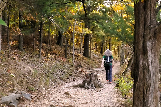
We walked the next morning, our first hike of eight for the trip, along the Wabash River. It was to be mostly a very sunny trip, and our first walk felt good. The river was running low, a trend we were to find across the Midwest. After our 1.8 mile walk we checked out of the hotel and headed further southwest.
I was reading Roadside Picnic, a truly amazing SF novel, on this trip. Walking past an abandoned something or other reminded me strongly of being in the "Zone."
The Mississippi River is about 540 miles from our house. Until it is crossed, it feels as if the trip has barely begun. Usually by noon of the second day we are battling through St. Louis traffic and making our way across a bridge from Illinois into Missouri, crossing the great river. At this point the scenery begins to change rapidly, as one cruises into the Ozark Plateau, following it all the way into Oklahoma along I-44. Huge hills lead to an up and down existence that more or less continues well into Oklahoma. Autumn leaf changes were only at about 10% on our journey south, so things were mostly still green.
Travellers gain an hour after leaving Terre Haute, and we arrived in Springfield, MO around 4 pm. We headed directly to Coffee Ethic, a perfect cafe in the downtown core. I had brought the wrong hiking shirt with me, so we had to visit Bass Pro afterwards to look for one I could use. I hike with a Columbia shirt with considerable SPF capability. We found one for me, and were soon on our way to the first of two favourite breweries. The Springfield Art Gallery is open late Friday till nine, but the whole thing is closed for a year for a rebuild, or something. So we had missed out on two galleries now. But the beer and atmosphere was fine at Hold Fast Brewery, located in a disused fire station. The doors were open, the weather was very fine, and we enjoyed ourselves thoroughly. We later moved on to Mothers Brewing, a very favourite stop for us. The beer was as good as it gets, and I had my first pumpkin ale of the season! I also stocked up on beer here. The trunk seemed to have limitless capabilities on this trip. Whatever we bought, we managed somehow to fit it into the trunk space. We stayed (free) at a very fancy hotel in south Springfield, The Bradford. We even got a welcome gift (Deb is a Gold Member at Choice Hotels) of munchies that served us well on our long drives.
Saturday morning it was time for another short hike, at the Springfield Conservation Nature Centre. We walked the Long Trail, something I had done years ago solo. This was Deb's first visit. After hiking, we headed back to the highway, again aiming southwest. Tonight we would be back in Lawton, OK, hopefully to have better luck hiking here than last year.
We followed the yellow Long Trail today, adding a loop from the Savannah Ridge Grail, also yellow. The trails give a nice introduction to the Ozark landscape.
We left around 11 am for Lawton. We stopped at Whole Foods in Tulsa for lunch and supplies. A fine liquor store next door furnished me with more ales to pack into the trunk. The highway was not as busy as we entered Oklahoma, which has toll roads. We used to have to stop and pay at a booth, but now we are billed electronically. We'll see if a bill ever arrives. On a stretch from Oklahoma City to Lawton the speed limit is 80 mph. Traffic wasn't too bad at all. This year we could see the Wichita Mountains while about 30 miles away. The air was very clear. Last year we were almost on top of them before Deb spotted Mt. Scott. After today, we would be off the interstate system for several days.
Day Four began by hiking in the Wichita Mountains National Wildlife Refuge. We chose three short trails today, adding up to about 3.3 miles of mostly easy walking. We did three out and back trails: Osage Lake, Burford Lake, and The Narrows. The three trails were quite different from one another, with the first one crossing a vast expanse of prairie to reach a small lake. The second one was more of a forest hike, while the third took us to secluded ponds with cliffs. We were done hiking by about noon hour, and had turned and headed for Amarillo.
Our second hike was to an overlook of Burford Lake. Note the very low water level.
All three Wichita Mountains hikes today. Osage Lake on left, Burford Lake at top, and The Narrows at bottom. From our GPS routes on Google Earth.
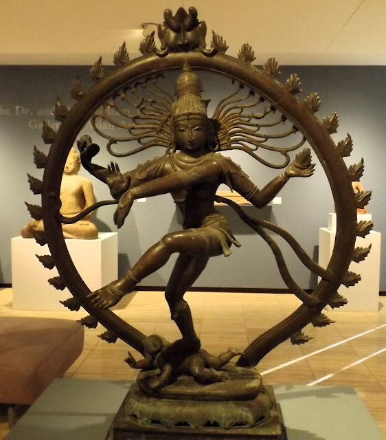
Driving west, and then northwest, towards Amarillo, TX, the mountains take a long time to dissipate into the flat, nearly featureless land that covers much of Texas and its northern "Panhandle" area. We were in time to hit a decent coffee shop in Amarillo, and then had the luxury of spending an hour or more in the Amarillo Museum of Art. They had some excellent displays today, including a showstopping photo exhibit called "Shades of Compassion," featuring the work of 41 photographers, several of them very well known to us and many that were not.
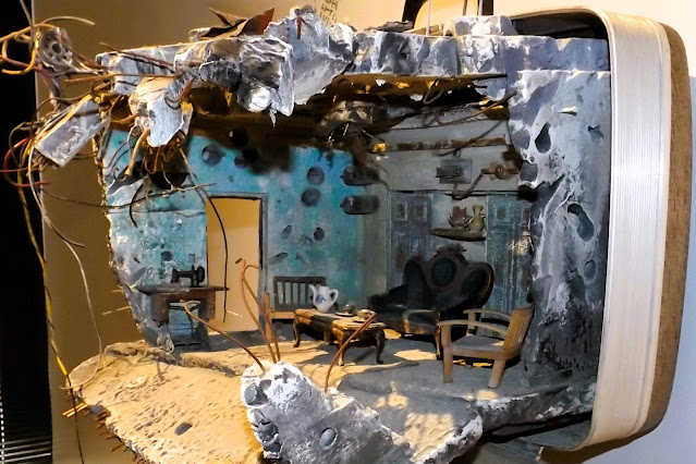
But the real star of the gallery today was an exhibit called "Unpacked: Refuge Baggage," created by Mohamad Hafez. Using actual suitcases used by refugees, he built miniature dioramas depicting half destroyed houses. It was a totally brilliant concept, and pulled off in a near genius way. We were completely enthralled by the exhibit!
We had worked up a powerful thirst at the museum (no cafe), and we headed to Pondaseta Brewery. We got comfortable outdoors with a flight of ales, and I left with more beer for the trip home. Not far from the brewery was Natural Grocers, where we went afterwards to purchase our in-room dinner. The hotel was close to the last two stops. We were now officially in the west, after six years of trying to get here. Tomorrow would be a different kind of hiking, as it would be from now on.
Don't miss Part Two, with big hikes in two different parks in Texas.
Mapman Mike


